Port Sanilac MI to Strathroy ON

St. Claire River
| Distance | (miles) |
|---|---|
| Day | 82 |
| Total | 2920 |
| Speed | (mph) |
| Average | 10.1 |
| Maximum | 20.5 |
| Expenses | ($ US) |
| Lodging | 37.99 |
A decent rain last night. Foggy and damp this morning. I didn't need the air conditioning, but the motel could use it to dry out. The bed was damp like an old sponge from the windows being open all summer.
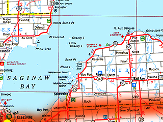
Irritating headwinds today, all day. Rode south on Michigan Highway 25. Parallel to the shore of Lake Huron, but I only caught an occasional glimpse of the water between the houses. The Great Lakes are private property in Michigan's Lower Peninsula. Construction for several miles but it didn't affect the shoulder much. Moderate rain for nearly an hour. Riding to work everyday, rain or shine, was excellent preparation for today. It had little impact on the ride. Another dumb question everyone asks. "What do you do when it rains?" The obvious answer that they should know. "Get wet, of course."
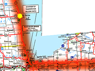
Transferred to a local road at Port Huron called Gratiot Road. I have no idea how it's pronounced. [Update: "Gratiot is pronounced like grash-it. Rhymes with Trash it."] Port Huron looks like an exurb of Detroit. Was quite surprised by the size of the bridge between Michigan and Ontario. The Blue Water Bridge is now two bridges: the old bridge, which is being rehabilitated and the new bridge, which stands beside it. Rode the last quarter mile of Interstate 94 to the new bridge anchorage. I expected I could ride across it but the bike and pedestrian access are not ready yet. Rode across the bridge in a bright orange Michigan Department of Transportation pickup truck. The DOT worker driving says they get enough bikes, all of which have to be carried across. Because of liability fears, he had to drive me all the way through the customs plaza. The Canadian customs officer asked the dumb question of the day. "What is this vehicle?" The DOT driver looked pissed. He tells me later. "I have to go through this a dozen times a day and they always ask the same question." I ask a bridge worker on the Canadian side for advice. He has a surprisingly strong Canadian accent.
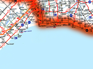
Head south on Front Street through downtown Sarnia then east on Confederation Street. Sarnia is over quick and Confederation Street becomes Confederation Line (a.k.a. Lambton County Highway 25). Absolutely flat. I love it. Cornfields and dairy farms. Not a single hill. Somewhere along the way the name of the road changes and the highway number with it (Middlesex County 39). Whatever the name, the road runs due east with only one small deviation around a river for over 40 miles to Strathroy where I decide to knock off. The sun is trying to come back.
Discovered my calling card won't work in Canada. Hope nobody thinks the worst has happened. The soap smells great at this motel.
 |
 |
 |
 |
 |
 |
 |
 |
 |